For more than 4 years, CATIE has been supporting and complementing the R&D teams of GEOSAT, whose expertise focuses mainly on 3D and 4D measurement technologies. While Algorithms and Data was previously the main contact for joint projects, the Dynamo project also involves our robotics and human factors experts.
GEOSAT uses cars equipped with 2 lidars, 1 GPS and 1 odometer for surveying urban environments. These environments, often made up of tall buildings, cause GPS signal losses that distort point measurements. To address the accuracy problem and the “double skin” effect caused by misaligned points, the Cyber-Physical Systems team proposes SLAM (Simultaneous Localization and Mapping) solutions already proven in robotics competitions. Building on the state of the art, our experts improve Google’s “Cartographer” algorithm, optimizing its parameters for GEOSAT’s needs. Back-propagating the positioning error correction when the GPS signal returns compensates for the drift caused by odometry and “SLAM”.
The team also proposes a visual odometry system to reinforce the mechanical system currently fitted to the vehicles’ wheels. Using an algorithm to realign and compare pictures of the road taken at very short, regular intervals, the car’s movement can be deduced and its position determined precisely.
Fusing data from the different sensors (GPS, odometry, LIDAR, inertial units) corrects the double skin problem and improves acquisition accuracy.
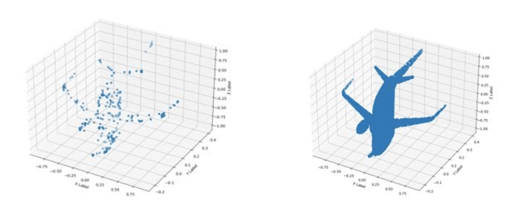
But with centimeter accuracy, the data collected runs to millions of points. Processing such huge point clouds is nothing new for our data scientists, who extract and analyze this data. It provides the information needed for the mapping and 3D reconstruction of the environment that GEOSAT offers its clients.
Cars are not the only ones surveying: surveyors also detect and mark existing underground networks. Safety, durability of ground markings and time savings are all issues our Human-Centered Systems unit has addressed by recommending improvements to the tablets currently used.
Working with a GEOSAT expert, the team tests various technologies and then makes recommendations on the app’s usability and the information users should be given so that they adopt the new tool.
CATIE’s main strength is the complementarity of its expertise and the interaction between its departments. It allows us to offer GEOSAT the skills of 3 technology centers within a single project team!
For more information: contact@catie.fr